Big Butte Springs
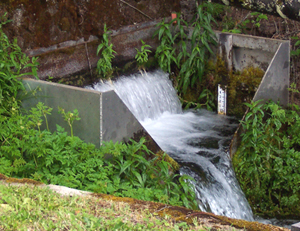
Spring overflow with gage
|
|
Medford Water's principal source of water is Big Butte Springs, located about thirty miles northeast of Medford, Oregon, between Mt. McLoughlin and the town of Butte Falls. The springs capacities vary from 25 million gallons per day (MGD) to 35 MGD and are the primary source of system water for the entire year. The maximum withdrawal from the springs, limited by the capacity of the transmission facilities and water rights, is 26.4 MGD. The water begins as snowmelt on Mt. McLoughlin and percolates through volcanic soils to emerge again as springs.
We hold three water rights equaling 67 cubic feet per second (cfs) on Big Butte Springs. The Oregon Legislature closed Big Butte Springs drainage from any additional appropriation in 1925 and assigned all remaining water rights to the City of Medford.
Big Butte Springs Watershed
The Big Butte Springs watershed is a multiple-use watershed consisting of 56,000 acres of private and publicly-managed lands. This watershed provides the recharge zone for Big Butte Springs.
Millions of years ago volcanic, glacial and erosion activity filled nearby valleys with permeable materials that now store and transmit vast quantities of water from the western slopes of Mt. McLoughlin (9,495 feet elevation) to Big Butte Springs at about 2,700 feet elevation.
As the primary source of drinking water for the City of Medford and surrounding communities (140,000 residents of the Rogue Valley), the springs are one of our commmunity's most valuable and significant resources. The springs discharge exceptionally high quality water that is consistently cold, clear and low in mineral content. Spring flows are collected underground and require only minimal treatment (disinfection only) to meet all current water quality standards.
The Big Butte Springs Watershed, or recharge zone, was delineated and characterized by the 1990 Big Butte Springs Geohydrologic Report. It delineated specific hazard zones or areas on the watershed that are susceptible to contamination from surface activities. These areas are under multiple ownership and management objectives. Therefore, a Drinking Water Protection Plan will be developed using the States Wellhead Protection Program guidelines in partnership with the other land owners and managers to protect and/or minimize risk to water quality on the springs watershed.
Medford Water works closely with the U.S. Forest Service (USFS) and other agencies in managing and monitoring all activities on the watershed that may affect water quality. About 75 percent or approximately 41,000 acres of the watershed is managed by the USFS. We own and manage close to 3,700 acres around Big Butte Springs and Willow Lake. In 1999, our organization contracted with the USFS for the development of a Forest Management Plan. Implementation of forest management activities began in 2000 and was completed in 2008.
|